Bago Mawlamyine Bicycle Ride
Around the Gulf of Martaban
Our Bago Mawlamyine Bicycle Ride would take us around the Gulf of Martaban. The Andaman Sea stretches from Banda Ache on the tip of Indonesia's North Sumatra. Bounded on its east side by the Malay - Thai - Myanmar peninsular and in the west by the Andaman and Nicobar archipelago beyond which lies the immense Bay of Bengal.
The Gulf of Martaban lies at the top end of the Andaman Sea where it is fed by the River Yangon in the east, the River Thanlyin in the west and the River Sittang at its northernmost point. flows into it It is often referred to as the Gulf of Mottama (Moke Ta Ma on Google) after its main port city of Mottama is an arm of the Andaman Sea in the southern part of Burma. The gulf is named after the port city of Mottama. Mawlamyine are southernmost destination in Myanmar lies immediately south of Mottama across the Thanlyin River.
Whist this was only six days of cycling we experienced myriad of wonders along the way.
Getting to Bago
Our choice to start from Bago was driven by necessity rather than desire as it was an easy flight from Bagan to Yangon airport and then a taxi to our first nights accommodation in Bago.
Bagan airport is little more than a small airfield just a ten minute drive from New Bagan by taxi. For this flight we were not charged for any excess baggage. The plane left on time and in just over an hour we were at the domestic terminal in Yangon. There is no baggage carousel here, just a team of porters unloading it from the plane onto large trolleys and bringing it to the outside of the terminal building. The four of us watched helplessly as the bike bags were thrown unceremoniously out of the hold onto the tarmac below.
Once we had claimed the baggage we had to pay a porter to take it outside as there are no luggage trolleys for passengers. Booking a taxi was straightforward at the taxi desk where the official spoke good English. Then we got the taxi to drive us to the International terminal to exchange more US Dollars into Kyat.
The distance by road from the airport to Bago is about 60km and very flat so we would have had enough time to cycle there before dark. Having read a few blogs written by other cyclists we decided to go by taxi. Highway 1 between Yangon and Bago is one of the busiest roads in Myanmar. All traffic heading out of Yangon to Mandalay in the north or Mawlamyine in the south uses this route and although there is a new toll expressway, most traffic goes on this old road.
We were glad we did. The road really was very busy and appeared to have been recently widened. There were three lanes of traffic in both directions with no hard shoulder, just rough ploughed earth at the side of the concrete. The taxi was right hand drive and Kjell was quite nervous travelling in the front seat as the driver attempted some fast, risky overtaking.
Bago is another 'ex-capital' of Burma and we stayed in the San Francisco Guesthouse. It is a very basic, but clean and well managed hostel. Although it is right next to the highway our rooms were at the rear so we were not disturbed by the heavy traffic. The staff spoke good English and were very helpful and knowledgeable.
In the late afternoon we walked to Shwethalyaung Buddha, an enormous and extremely attractive Buddha image. The sun was setting. There were not many restaurants in the town centre but we had a passable Chinese just across the road from the guesthouse in a place that was not sure if it was a garage or a restaurant.
Schedule
Our ride descriptions give an account of the ride that we completed. As part of the description we also provide links to Wikiloc or Google maps and elevation profiles based on mapping data available through the internet. The ride profiles are smoothed to give what in our opinion is a more beneficial view of the profile. We use paper maps, GPS and on line data to plan and conduct our rides. We are happy for you to use our descriptions, but be aware that we do not guarantee the accuracy of the information provided as situations surrounding any ride change over time.
Bago Mawlamyine Bicycle Ride - Day 1 - Bago to Kyaikto
- Distance 93km
- Max Elevation 68m

Bago Mawlamyine Bicycle Ride - Bago to Kyaikto Ride Profile
Ride Description
Today we broke all records and were kitted up and ready to depart at 6am. The sun wasn't even up and we caught a pink sunrise over the Shwemadaw Paya.
 Dawn at Shwemadaw Paya
The first 15km was along Highway 1, the main road between Yangon and Mandalay and the busiest in Myanmar. Although a new toll motorway has now been built it is little used with most traffic choosing to avoid the tolls.
As the guesthouse didn't serve breakfast we planned to ride to Hpa Yar Gyi and have breakfast there, before turning off onto NR8 which follows the western coast southwards
 Washing Up
It was not as bad as we had anticipated and we made very good progress on the flat road before enjoying a typical tea-house breakfast of coffee and pakoras. From there it was another 35km of flat riding, through extensive rice paddies. NR8 was much quieter than Highway 1 but still had its fair share of buses, all carrying tour groups to Golden Rock.
 Ploughing with Oxen
Roadsides stalls had interesting displays of fresh and dried fish, none which we recognised. We stopped several times for refreshment at little family run food stalls who were grateful for our custom.
 Dried Fish Vendor
After crossing the wide river Sittang the route undulated over low rubber planted hills. The afternoon heat and little shade made it tiring. Arriving at Kyaikto, on the main road, we enquired about a room at two guesthouses but neither was licensed for foreign guests.
 Drying Latex
They advised us to go 5km along the road towards Kingpun to the Mountain View Resort. We managed to get their last two available bungalows. A couple of large tour parties had booked all the rest of their accommodation. The bungalows are spread over a large area of wooded gardens, and ours were the most remote, quite a walk from the restaurant and reception. There was no choice that night but to eat in the resort restaurant which was busy and lively.
Kyaiktiyo (Golden Rock) - Day Off
It rained heavily during the night, turning the loose red earth resort roadways to sticky, heavy mud. The walk to and from the restaurant for breakfast covered our Birkenstock sandals in red mud so we left them outside on the patio to dry while we went off to see Golden Rock. We pushed the bikes down to the gates to stop the tyres getting coated as well.
 Pretty In Pink
We quickly cycled the ten kilometres to Kingpun, the departure point for Mount Kyaiktiyo and Golden Rock. From here there is the option of walking all the way to the top which takes about five hours, or riding up on one of the large trucks.
Even if we had felt inspired enough to cycle to the top, it would not be possible as the road is closed to all other traffic except the trucks, so we locked them up and made our way to the truck station.
 Parasol Vendor
The open backed lorries are fitted with wooden planks for seats. There are about six rows of seats, each seating six people, a bit of a tight squeeze for Burmese bottoms, nigh impossible for European ones.
To get into the truck entails climbing up a rickety metal wheeled set of steps and leaping across the gap onto the truck then climbing over the seats to find a place. A task better suited to 20 somethings, not retirees.
 OMG. How risky can this be?
Having secured a place on one truck, we were told to get off by an official and get on the 'tourist' truck on the other side of the garage. After repeating the risky boarding procedure we found that this truck only went three quarters of the way up to the top and then there was an hour's climb to the rock itself.
By now the first truck had filled with passengers and departed so we had to get on another and wait again until all the seats were filled before departing. The truck set off along the concrete road and began the slow, 15km climb up the mountain. It was narrow road but there were regular passing places so the descending trucks could pass.
 Transport to Golden Rock
Halfway up there is a compulsory stop as the next section of road is single track, and an opportunity for the driver to collect the fares. We waited while five trucks descended and then the queue of uphill ones set off. This part was much steeper, with tight hairpins and a 25% gradient.
 The Truck In Front is a Toyota
About 500m short of the 1,100m summit, the trucks unload their passengers in a dusty parking area. Litter bearers are on hand to carry the physically challenged or just plain lazy.
 Golden Rock Litter Bearers
Porters with baskets wait to carry people's luggage. There are lots of hotels and rest shelters on the mountain top and everything they need has to come up by truck.
 Golden Rock Picnickers
It felt like a bank holiday in England with crowds of friends, monks and family groups all toiling up the steps with picnics, blankets, babes in arms, and temple offerings. All along the route are vendors selling drinks and food, rosary beads, religious icons, and toys.
The final insult is the government entrance fee for foreigners of $10 each.
 Golden Rock temple Steps
The rock itself is impressive, teetering on the edge of a towering precipice and glowing against the dark clouds billowing behind it.
The rock's surface is covered with a thick layer of pure gold, with men (only men are allowed to apply gold leaf) queueing up to add more......
 Golden Rock
while their wives and children burn incense and pray in front of the many golden Buddhas.
 Women's Prayers
The views from the plaza over the surrounding mountains are impressive but, generally, everything else is a bit tacky, dirty and too crowded.
 Mountaintop Village
We took many photographs and then got a truck back down to Kingpun for lunch. From there it was an easy ride back to resort.
 Transporting Bamboo
In the evening we got ready to walk down to restaurant then realised our sandals had disappeared from the patio and also our plastic water bottles. Kjell suggested that one of the many dogs roaming around the resort may have tried to eat them but it seemed strange that it would take all four of them. After we reported the problem to reception they sent one of the waiters off with a small torch to search for them, an almost impossible task in the velvety darkness.
At about 10.30pm we were in bed when a loud knock on the door woke us. An older man and two local teenagers stood on doorstep holding the missing footwear. "Where did you find them?" we asked to shrugged shoulders. There were no teeth marks in the cork soles and the straps on both pairs had been adjusted to fit someone else's feet. Then we felt terribly guilty and wished we'd just gone and brought new sandals
Bago Mawlamyine Bicycle Ride - Day 2 - Kyaiktiyo to Thaton
- Distance 74km
- Max Elevation 42m

Bago Mawlamyine Bicycle Ride - Kyaiktiyo to Thaton Ride Profile
Ride Description
Today's ride continued to follow NH 8 south on flat roads, through rubber and palm plantations with herds of grazing buffalo.
 Buffalo Grazing in the Rubber Plantations
There were many local industries evident along the route: nipa thatching......
 Unloading Traditional "Nipa" Thatching
...bamboo furniture, woven grass matting, latex...
 Bamboo Furniture
....bricks and pottery.
 Pot Bowls
With a flat road and light traffic we made fast progress and arrived in Thaton by lunchtime. We stopped at the first guesthouse on the outskirts of town but it was very basic.
 Boys fishing at Thaton
A man at the house on the opposite side of the road beckoned us over and gave us red bean ice lollies, a strange textured delicacy. There was a group of teenage girls living next door to him who peeped at us through the hedge, giggling and whispering.
 The Girls next Door
Eventually they were persuaded to come round to meet us and as usual all wanted to take photos of us on their mobiles. After four hours of hot sweaty riding we were not looking our best!
Refreshed by the ice creams we continued into the town and saw a hoarding advertising a hotel called 'Two Lakes'. The town was pretty basic with little of note except for the usual pagoda in the centre. We searched for the hotel and asked around with no success.
 Inventive Recycling
Then we paused outside a small wholesale shop whose owner who spoke good English. He gave us directions and phoned the hotel to book rooms for us.
It was about 5km out of town on the NR85, the road to the Thai border at Mai Sot. We were the only guests in this newish hotel and the rooms were very good, but there were lots and lots of staff just sitting around doing very little. In the evening we dined on the patio at the side of the large pond with its fountains and fairy lights. The meal was good, especially the rather nice bottle of wine.
Bago Mawlamyine Bicycle Ride - Day 3 - Thaton to Mawlamyine (Moulmein)
- Distance 70km
- Max Elevation 23m
 Ride Profile")
Bago Mawlamyine Bicycle Ride - Thaton to Mawlamyine (Moulmein) Ride Profile
Ride Description
This morning we rode back into Thaton to continue south on NR8. Again the landscape was flat and most of the agriculture was around palms, bamboo and rubber. The road crosses three main rivers and each of the bridges had a military control with armed guards, and bunkers at the roadside.
 River Scene From Moulmein Road
Early morning is the time for the monks to walk the streets collecting donations of food from the local businesses. The senior monk walks at the front with the younger boys behind.
 Monks setting off to collect food
It was cloudier today so more pleasant for riding. After 20km we stopped for a mid-morning drink and Karen realised she had forgotten to hand back the hotel room key.
 Temple Sculptures
As we sipped our cold drinks we spotted a couple of touring cyclists coming from the opposite direction. They were so focused on their ride they nearly cycled straight past us but we called them over to exchange information. They were Jessie and Georgia, a young British couple who had entered Burma by boat from Ranong in Thailand. According to all our sources this is not allowed but they had had no problems getting across the border with the bikes, having got their visas in Bangkok.
They told us that the ride north through Tanintharyi, Burma's southernmost state, had been a nightmare, with rough, unsurfaced roads over steep mountains, with very few places to stay. They carried a tent so camped in palm plantations. Some of the people they had met in the villages had never seen a Westerner before but they were made very welcome and cared for by the locals when they were in despair because of the arduous terrain. We were able to give them advice on guesthouses on the way to Yangon and assure them that the roads north were smooth and flat. In return they promised to take the room key back to the hotel in Thaton.
A ridge of tree clad hills runs parallel to the road, dotted with countless stupas and temples. The last obstacle before Mawlamyine is the wide Thanlwin River. From the river bridge are distant views of jagged karst rock formations rising out of the huge flat river estuary.
 Bridge over the Thanlwin River
Our accommodation in Mawlamyine was the 'Cinderella Hotel' which lived up to it's glowing LP review with spacious rooms and the best stocked mini-bar in Burma.
 Traditional Burmese Puppets
Mawlamyine
This place is yet another ex-capital of Burma, in the hey-day of the British Empire. Consequently there are lots of crumbling, moulding, colonial buildings and a liberal sprinkling of Christian churches.
 Moulmein St Mathew's Church
Steve and Kjell were both feeling ill this morning so sightseeing was somewhat curtailed. We took a gentle ride to the top of the ridge to the east of the town which has at least six temples built along its length.
 Temple Figures
From the ridge there are good views over the town and river.
 Moulmein
 Sunset at Moulmein
Bago Mawlamyine Bicycle Ride- Day 4 - Bilu Kyun Island
- Distance 50km circular ride
- Max Elevation 25 m
Bago Mawlamyine Bicycle Ride- Bilu Kyun Island Ride Profile
Ride Description
Bilu Kyun is a large island, just off the coast of Mawlamyine. It's name literally means 'Ogre Island' and some stories suggest that the inhabitants used to be cannibals. There is no tourist accommodation on the island, but its size makes it ideal for a day trip on a bike.
 On the boat to Bilu Kyun
A passenger ferry operates from a jetty at the north of Mawlamyine, but it was easier, with four bikes, to hire a private boat from the jetty further south.
The crossing only took about 10 minutes and there were plenty of porters at the other side to help lift the bikes. A rough red dirt track leads inland, through the usual flat rice paddies. There are few four wheeled motor vehicles here, although motorbikes are starting to replace the traditional pony and ox-carts.
 Which way?
Most of the island is flat, with endless rice paddies. A narrow spine of low hills runs down the centre, with a circular metalled road running around it. Part of the road was in a very bad state and was gradually being widened and repaired.
 Local Farmstead
It was a Saturday so the children were not at school and it was a delight to see them all playing the games which used to be so popular when we were young: marbles, whip and top, skipping and ball games.
 Playing Whip and Top
Not many independent travellers make it here, most people arriving in small organised tours, so we were a great novelty.
 Marbles using wooden balls
A man on a bicycle stopped and welcomed us to his home town and took a 50,000 Kyat, ($5) note out of his wallet. He wanted to give us this money to spend on the island to encourage local business. Our initial attempts to refuse his generous gift were obviously upsetting him so we accepted it and spent it, as he requested, in an eating place in Chaungzon, the main town.
 Our Benefactor
The inhabitants of the island are from the Mon ethnic group, with their own unique styles of building, dress and hats.
 Local hardware
Passing a local house we heard children singing and stopped to investigate. The youngsters were very shy but loved seeing their images on the camera.
 School Children Singing to us.
Riding up the west side of the hills we couldn't resist buying watermelon at a roadside stall. We asked them about local craft workshops which we had read about but not yet seen.
 Water Melon Seller
The stall owner got on his motorbike and led us along narrow village streets to a pipe maker and walking stick carver.
 Carved wooden pipes
As we returned to the jetty to get the boat back the sun was low in the sky casting long shadows.
 Buffalo on the lane
Several motorbikes passed us carrying Indian women in their finest clothes, going to a wedding.
 Wedding guests
Bago Mawlamyine Bicycle Ride - Day 5 - Mawlamyine to Hpa-an
- Distance 63 km
- Max Elevation 36 m

Bago Mawlamyine Bicycle Ride - Mawlamyine to Hpa-an Ride Profile
Ride Description
Today's was one of the most beautiful rides we did in Myanmar. Heading north out of Mawlamyine the road crosses two broad tributaries of the Thanlwin River. Both had suspension bridges of similar construction, the second one being much longer than the first. They had a metal road surface constructed out of longitudinal strips about 10cm wide, with 3cm gaps between them, just big enough for a bike tyre to drop into.
 Bicycle Trap Bridge
The only way to ride across was to zig-zag across the width of the road, impossible because of the other traffic, or keep the tyres on a single slat all the way across. Instead we got off and pushed.
 Caught in the trap.
Turning off the main road we followed a track to the Kha-Yon caves. A seemingly endless line of Buddha statues runs along the roadside, leading to a monastery at the base of a limestone outcrop and the cave entrance.
 Statues along the track to the cave
There are a couple of small unlit caves here filled with religious icons.
 Beautiful but mysterious statues
At the sheltered base of the cliff, a group of men were creating new statues and reliefs, painting them in bright gaudy colours.
 Gaudy Ogres
The road continued north through the wide Thanlwin river valley. The rice had been recently harvested and the farmers were busy ploughing their fields. Instead of oxen or hand ploughs, these men all had new looking rotovators, a sure sign of increasing affluence
 Traditional leaf thatched building
The main ethnic group in this area is the Karen. Their tradition house is built of teak on stilts and has small square bay windows, glazed with brightly coloured glass. Some of them are being replaced with brick and concrete houses.
 Traditional Karen farmstead
The flat alluvial valley is dissected by high, sheer sided limestone mountain ridges that from a distance looked like craggy islands rising out of a green sea.
 Zwegabin Mountain
Hpa-an was a much bigger town than we had expected. The Angel Land hotel that had been recommended by staff at the Cinderella was disappointing. Newish but poorly maintained with indifferent staff, overpriced rooms and a ridiculously expensive restaurant with no customers.
 Children playing foot volleyball
The centre of the town and the few alternative restaurants were a 10 minute cycle ride away.
 Hpa-an Lake
Hpa-an - 2 days off
There was plenty to see around the town to fill our two days. Kjell called into the Sou Brother's Guesthouse and picked up a very useful sketch map showing all the places of interest and the distances to them. On the first day we did a short circular ride.
 Roadside Geese
First stop was Kyauk Kalap, a tall, narrow, time sculptured sliver of rock with the usual small pagoda atop. At the base of the rock is a small monastery and surrounding both a circular lake, crossed by a footbridge.
 Lake at Kyauk Kalap
There are numerous stalls selling food and drink and the usual temple offerings, including popcorn for the lake fish. It looked very strange seeing shoals of catfish feeding at the surface with their 'whiskers' sticking up above the water.
 Kyauk Kalap
Next stop was Mount Zwegabin, the highest of the mountains surrounding Hpa-an. It is an impressive sight, 700m of bare rock, thrusting up out of the flat surrounding plain. On the approach to the path to the summit are over 1,000 identical seated Buddha images.
 Mt Zwegabin and 1,000 Buddhas
The climb to the top is a popular pilgrimage for locals. The stepped path is well maintained and there are over 2,500 to climb before reaching the top. We set off at a cracking pace, despite the heat and passed several small family groups on the way up. They all wanted the usual photos and to practise their English.
 Girl on the way up the mountain
The mountain sides are populated by monkeys who survive on food from the monks and tourists. They are very adept at emptying crisps and biscuits from plastic wrappers and nibbling holes in the bottom of plastic bottles to drain them.The photo on the right has had the enormous mounds of plastic rubbish littering the mountain summit edited out.
 Zwegabin Monkey
It took us 90 minutes to reach the top and the views were stunning, a 360 degree panorama, only marred by the heat haze.
 View from the top of Mt. Zwegabin
Descending was much more painful than the ascent and our knees were very uncomfortable by the time we got back to the bikes.
 Young monks at the mountain top
It was a hot ride back to Hpa-an in the mid-day heat but there were good views of the mountain top. We rode back into town on a quiet road on the side of the lake.
 Road at the foot of the mountain
On the second day the four of us decided to go to Saddar Cave, which according to the Sou Brother's map was about 20 miles from Hpa-An. Andrea and Kjell were keen to go by bicycle but Karen and Steve suggested getting a car and driver for the day as the only information we had to find it was the very crude sketch map.
The hotel arranged for a car and driver for $40 for the day. We later learnt that the driver only got $30, $10 being the hotel's commission. It would certainly have been difficult to find it on the bikes as it was about 5km down a dirt track with no signposting.
 Fishing shelters on the way to Saddar Cave
The cave looks much like all the rest of the cave pagodas from the outside, with its ornate gateway and sprinkling of religious icons.
Steve was shown the way to the monks office where, with the help of the guide, he had to ask permission for the cave lights to be switched on and give a donation towards the cost.
 Cave entrance gate
Once the generator was fired up the immense size and scale of the first cavern could be appreciated, with pagodas, statues and Buddha reliefs all over the walls.
 The first cavern
From the far end we scrambled up a slippery rock slope through more caves. There were massive petrified waterfalls....
 Sadar Petrified waterfall
...huge rock pillars and these incredible circular drip holes. High above our heads were 1,000's of bats that muttered bad temperedly as we shone our torches onto them. We muttered at them for the slippery mounds of droppings that they had produced.
 Sadar Round holes formed by dripping water
At the far end the cave ended high above a placid, tree fringed 'secret' lake hidden from the world by the surrounding rocky cliffs.
There were several canoes on the lake shore and a small group of fishermen. On the far side of the lake was another, half submerged cave.
 Sadar Cave The secret lake
We hired two of the canoes to take us through the submerged cave and back to the temple entrance through the lake on the other side.
 Going into the submerged cave
Emerging at the other side of the cave we paddled quietly through a vast shallow lake and back to the car park at the cave entrance.
 The lake
On the way back, we stopped to see Lakkana, a peaceful Kayin village which retains its traditional feel as its only access is via a footbridge.
 View from Lakkana village
In the evening we sat at a small cafe on the banks of the river drinking beer. The sunset was spectacular but marred by the ugly, smoking cement works on the far side. Below us on the river bank families were coming down to the water to bathe and a man was fishing with a circular net.
 Hpa an River fishing
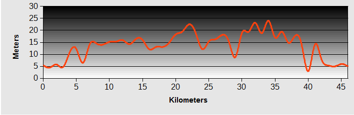
Bago Mawlamyine Bicycle Ride - Day 6 - Hpa-an to Thaton
- Distance 46km
- Max Elevation 22m

Bago Mawlamyine Bicycle Ride - Hpa-an to Thaton Ride Profile
Ride Description
For the last few days we had been discussing how to get back to Yangon. Cycling back would mean retracing our route along NR 8. The alternatives were: public bus, train, taxi or private mini-bus. Karen and Andrea were keen to take the train but Kjell was worried that the ride would be very long and uncomfortable and preferred to book private road transport. Steve was not taking sides.
Train travel in Burma is notorious for its slowness, lateness and high cost, but there is something about train travel which seems to get you close to the real world of the local population. After a few days we wore Kjell down and he agreed to catch the train. We had read that tickets can only be purchased on the day before travel, not on arrival at the station. The hotel manager at Thaton, who we had met on the way south, spoke good English so we decided to ask her to organise tickets for us.
So today would be the last day of cycling with our gear. A team photo was compulsory.
 Hpa An Departure Team Myanmar
It was a relatively short ride on NR85 to get back to Thaton. We had read a blog by a cyclist who said that this was one of the most unpleasant and hardest rides of his trip and another report that it was very scenic, so we left with an open mind.
 Thanlwin River houses
The first good news was that the bridge over the Thanlwin river had a tarmac surface. On the other side we passed the ugly cement works that we had seen from the town. The traffic was not as heavy as we had feared on this Thai border crossing route.
 Thanlwin River
But is wasn't particularly beautiful either. There was little agriculture and lots of low scrub suggesting that many large trees had been harvested. The road passed several large military bases and there were some checkpoints on the road.
A policeman on a motor bike started trailing us. He kept riding past, then stopping and waiting for us to pass him again. When we stopped for a drink at a road stall he kept an eye on us till we left, then rode off back the other way. Was he protecting us from the locals or the other way round?
We reached Thaton before lunch and talked to the manageress about the train tickets. The first thing she said was 'don't go on the train'. But our minds were made up and she rang the station to ask about tickets. Upper class tickets were available on the day of travel and they required copies of our passports. The bikes would be transported in the freight carriage for a small extra cost and we had to pay in dollars.
 The blue sign is NOT part of the bike
Bago Mawlamyine Bicycle Ride- Day 7 - Thaton to Yangon - By Train
Ride Description
It is about 5km to the station from the hotel, and the scheduled departure time was 09.50h. As we ate breakfast we were anxious to see that the man who was going to buy our tickets was still in the restaurant. Once he returned with our tickets we set off. Another member of the hotel staff went with us on a motorbike, to guide us to the station.
 Thaton Station
The platform was pretty quiet, just a few people asleep on the concrete and a couple of food vendors.
 Platform vendors
At the far end of the platform a steady stream of porters were bringing cardboard cartons on their heads and stacking them, ready to load on the train. They contained sachets of '3 in 1' coffee mix and were being unloaded, one at a time, from a huge articulated lorry that appeared to have carried them from Thailand.
 Steady stream of porters
Our bikes were taken by the porters ready for loading and we hung around and waited.
 Bikes wait with the freight
The train arrived at 10.30h and there was no shortage of people to direct us to our reserved seats in the 'upper class' coach. In most other countries this would have been in a museum.
 The train arrives
There were no windows, the plywood roof was rotting and the once luxurious reclining seats were battered and stuck in a single position, about halfway between sit-up and lie-down. We were the only western passengers, but there were few empty seats
By the time all the freight was loaded it was 11.00h and we slowly exited the station. At first,except for the slow speed, we thought all those people who had warned about the rough ride were exaggerating.
With the upholstered seats it was quite bearable, although we had sympathy for the folks in the ordinary, wooden seat carriages.
 Burma Railways First Class carriage
Then the train gathered speed and the bumping started. It was as if the distortion of the rails and the train's speed reached a resonant frequency and the jolting action it produced propelled everyone upwards, out of their seats for a second before depositing us harshly back down and repeating. It seemed like a miracle that the train didn't derail. Reading, eating or drinking were out of the question on the worst sections but still the vendors walked up and down the corridors, balancing their trays of food on their heads. Kjell gave us one on those 'told you so' looks, but Karen and Andrea got a fit of the giggles.
 Perfect poise
There is something about travel by train that is different from being on the road. The railway often runs through the poorer areas, land near the line is cheap and available. From the carriage you can look into people's homes and see how they live from day to day. At the stations people wait for the arrival or departure of family members. Hawkers sell goods through the windows or range up and down the aisles. School children wave and shout, farmers tend their fields and animals.
Progress was painfully slow until Bago. Here the train joins the Yangon to Mandalay line which is much better maintained and we picked up speed - a little.
 Schoolchildren waving
It was now 18.30h, the sun had set and there were no lights in the carriage. So even looking out of the window was impossible. The train arrived in Yangon station about 20.00h
We had booked rooms at the Motherland Inn 2 again. From the station it was about 4km to the hotel, along unlit streets in heavy traffic that is not used to seeing many bicycles. Steve was in the lead with the sat nav and did an admirable job of navigation. The most memorable manoeuvre was a left turn, across six lanes of unpredictably moving heavy traffic with Andrea holding out her hand to stop the traffic and us following behind.
Link Back to our Tours Page from Bago Mawlamyine Bicycle Ride.
New! Comments
Have your say about what you just read! Leave me a comment in the box below.