Vietnam Highlands Easy Rider Tour &
Return Cycle Ride Along The East Coast
The Vietnam Highlands can be found in the province of Tay Nguyên, literally translated as the Western Highlands, but more usually referred to as the Central Highlands. It comprises the five provinces of Dak Lak, Dak Nong, Gia Lai, Kon Tum and Lam Dong. We took the service bus from Saigon to the old French hilltop station of Dalat. Our bikes traveling by separate transport arrived in Dalat before we did. From there we booked a three day motor bike tour around the Vietnam Highlands and our bikes were transported to Di Linh were we collected them on completion of our tour. Reunited we then cycled to Phan Thiet on the coast and headed south and then inland back to Saigon.
Schedule
Our ride descriptions give an account of the ride that we completed. As part of the description we also provide links to Wikiloc or Google maps and elevation profiles based on mapping data available through the internet. The ride profiles are smoothed to give what in our opinion is a more beneficial view of the profile. We use paper maps, GPS and on line data to plan and conduct our rides. We are happy for you to use our descriptions, but be aware that we do not guarantee the accuracy of the information provided as situations surrounding any ride change over time.
Vietnam Highlands - Day 1 - Ho Chi Minh City to Dalat by Bus
- Distance 294km
Ride Description
With just over two weeks left before our flight to the Philippines we
decided to explore the Vietnam Highlands around Dalat and then ride back to Ho Chi Minh city along the
south-east coast. We asked the hotel receptionist to book bus tickets
for us to Dalat and make sure that we could take the bikes. After a long
telephone conversation she assured us the bikes could be transported
and that we needed to ride to the Travel Agent's offices for 7.30am,
about 15 minutes ride.
Checkout wasn't simple as we had to book a room again for our return in
two weeks time as well as arrange for the hotel to store a bag of
Christmas presents which we didn't want to lug around Vietnam. The
upshot of all that was that we went off without collecting our
passports. Steve cycled back to pick them up and once he returned we set
off thinking we were going to get on the bus.
Instead we were guided up to the bus company office where we had to
leave the bikes to be taken separately as freight. We got a bit angry at
this point as no-one had explained this and now we were about 750m away
from the bus and had to lug all our luggage back down the road. By the
time we got back to the bus station the bus had left so we had to wait
an hour for the next one.
The bus was a 'sleeper' with no seats but two levels of beds. It was
actually quite comfortable if your legs weren't too long. The journey of
300km took over seven hours as progress was slow because of heavy
traffic to start with and then the poor road and frequent roadworks. The
kilometre markers at the roadside seemed to pass just as slowly on the
bus as they do on the bike, but at least the uphills were less painful.
Dalat lies in the Vietnam Highlands at 1,500m above sea level. The temperature difference was startling.
Although we had set off before the bikes, they had arrived already and
were waiting for us at the freight office. We had to put on our wind
proofs and switch on the bike lights as the sun had set. It was
difficult to cycle up the hills after not climbing anything other than
small bridges since the border of Thailand and Cambodia. In the dark we
lost our way a couple of times so ended up booking into the first hotel
we saw which was not very good. The next morning we moved to a better
one in the centre of town.
Vietnam Highlands - Day 2 - Dalat to Di Linh -Three Day Easy Rider Tour
- Distance 408km
Ride Description
After studying the map of the Vietnam Highlands to the north west of Dalat it was obvious it would be difficult to tour there by bicycle. The distances between accommodations were long and the terrain very hilly so we decided to book a tour on motorbikes. Dalat has a company called 'Easy Riders' who supply knowledgeable and competent motorbike drivers to show tourists the sights and how local people live and work in the Vietnam Highlands.

We teamed up with two 'old guys' (i.e. about the same age as us), Titi and Riep for a three day tour. They arranged for our bicycles to be shipped to Di Linh, about 73km south of Dalat ready for us to continue our ride from there.

Over the three days we travelled about 500km through the Vietnam Highlands, stopping frequently to visit local businesses such as flower farms, coffee and tea plantations.

We saw silk spinning, tofu making, chopstick manufacture, sugar production, basket and brooms being made.

There are still some minority groups in the Vietnam Highlands living in traditional long house villages but things are changing fast and everywhere the old traditional buildings are being replaced with modern ones

The communist group farms are gone and now people can own land and make profits. Immigrant farmers who came Vietnam Highlands from Hanoi at the end of the war are gradually replacing the simple wooden huts that they lived in with stylish villas, funded by the profits from their coffee production. Vietnam is now the second largest producer of coffee in the World, behind Brazil. The downside is that a lot of tropical forest is being replaced with coffee plantations.

The tour also took us through beautiful tropical rain forest, visiting impressive waterfalls, the scenic Lake Lak area and along the famous Ho Chi Minh road near the border with Cambodia.

The route back to Di Linh reminded us how glad we were to be on motorbikes as we repeatedly climbed and descended 10% gradients and struggled to find anywhere serving food for lunch.

At the hotel in Di Linh we bade goodbye to Titi and Reip and had to part with a frightening amount of Dong to pay for our tour, but worth every cent.

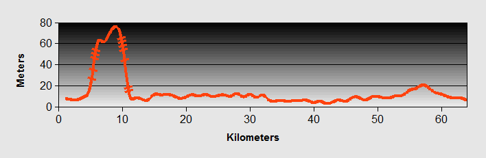
Vietnam Highlands - Day 3 - Di Linh to Phan Thiet
- Distance 100km
- Max Elevation 1238m

Vietnam Highlands - Di Linh to Phan Thiet Ride Profile
Ride Description
Today's ride was one of the most scenic and enjoyable ones of this trip and would see us leaving the Vietnam Highlands behind us. Setting off from Di Linh there was a short descent before a gradual climb up to the Di Linh plateau at 1,243m. The road was very quiet and well surfaced, climbing initially through coffee plantations and pine trees before reaching more mature forest towards the top. It was cloudy at first and by the time the sun came out there was plenty of shade from the trees.

From the summit there was a shortish descent onto a plateau and then another gradual climb to the minority village of Gia Bac. We stopped here for coffee at a little cafe at the south end of the village. The owner spoke some English and gave us biscuits with our drinks.

From here we started the descent towards the coast, about 20kms of winding road through thick bamboo jungle with amazing views towards the mountains of the Southern Vietnam Highlands.

The only traffic was a few motorbikes climbing up and we realised that
for the first time in several weeks we could actually hear bird song.
The descent was made more challenging by the road repairs which had left
a thin layer of loose fine gravel on the bends which meant careful
braking.
After that the road flattened but still continued a gradual fall all the
way to the coast as we saw the Vietnam Highlands disappearing into the distance. Stopping at a cafe for a milkshake we watched the
lady owner mix about 15 tall glasses of yogurt drink and put them all
onto a small round tray. Her husband started up his motorbike, she
jumped onto the back, balancing the tray on one hand, and they went off
down the road to deliver them.
Arriving at Phan Thiet we needed more refreshment so sat in a bar
overlooking the river for a beer. The young man on the next table
started to chat to us and offered to take us to a 'cheap hotel' despite
our protestations that we could find a hotel without his help. Then a
group of questionable other young men arrived and sat with him at the
table. He lost all interest in us and a conversation in very low voices
began. We decided he was a drug dealer so disappeared quietly while he
was doing his business.
On the seafront was a large,smart, fairly new hotel overlooking the sea
and booked in for 2 nights. Best of all, there was a pretty good
restaurant just a short stroll along the prom.
Vietnam Highlands - Day 4 - Phan Thiet to Phuroc Hoi
- Distance 72km
- Max Elevation 76m
Vietnam Highlands - Phan Thiet to Phuroc Hoi Ride Profile
Ride Description
The traffic in the town was manic as we made our way over the river, past the enormous fleet of fishing boats and the busy fish auction. It was such a relief to turn onto a minor road towards the coast. After a few rolling hills we dropped down near the sea and an expensive new resort called Eden. Continuing near to the beach we passed many other resorts but very few of them were operational. Many were half built and abandoned and the others were under construction. They spoilt what was otherwise a lovely stretch of coastline with scattered fishing villages, high sand dunes, a tree lined beach and very few people.
We continued towards the headland at Ke Ga. The pale sand beach here
has impressive wave sculptured rocky outcrops but yet more abandoned
and derelict resorts.

On the headland is a lighthouse and we cycled down a rough track to get a photo. A lady on a motorbike persued us, anxious to sell a lighthouse tour, but we were content with the photo.

A local man on the beach insisted on being in the photos.

Beyond the headland the road turns more inland. The sandy dry soil here is very suitable for growing dragon fruit and we passed through endless fields of cacti and then large numbers of shrimp farms.

Phuroc Hoi was another busy fishing town with a lively, friendly feel to it. We found a small hotel not far from the river. That evening we ate a delicious meal at a street place and wandered round the town marveling at the number of shops selling gaudy electric Christmas lights. The evening service at the RC church was standing room only and the Buddhist temple further down the road was just as popular.
Vietnam Highlands - Day 5 - Phuroc Hoi to Ho Tram
- Distance 71km
- Max Elevation 91m

Vietnam Highlands - Phuroc Hoi to Ho Tram Ride Profile
Ride Description
As we came out of the hotel this morning there was a large crowd of people, all watching four policemen marking up the road following yet another motorbike accident. We sat drinking coffee at the cafe opposite watching the watchers. Next to us a man was giving his prized cockerels a morning wash and brush up, washing and drying their plumage and applying red dye to their legs and faces.

We left town on a quiet road along the coast. The sand dunes here are much higher and there is no agriculture at all. After a couple of kilometres the road turned more inland and joined highway 55 as far as Binh Chau. We considered stopping here for the night but the only hotel didn't look too inviting.
Taking the road to Ho Coc we passed another huge fenced area with plans for a 5 star resort and golf course. Beyond this was a long stretch of beautiful untouched coastline with only a small shanty type fishing village and several kilometres of deserted beach, lined with forest and freshwater lagoons.

Then in the distance we spotted a monstrous new resort and casino development by MGM. A 20 floor high tower that dominates the skyline and spoils the beautiful views. It is due to open early in 2013 and the massive car-park was filled with buses and motorbikes to transport the many hundreds of locals employed in its construction.

We stopped several times to try to get accommodation. The first resort was $100 a night, the next wanted $30 for a musty room, the next offered a room with 2 huge beds and a mattress on the floor with dirty bedlinen. Finally we settled for a motel up the road with a rock hard mattress but at least the sheets looked clean.
Vietnam Highlands - Day 6 - Ho Tram to Long Khan
- Distance 78km
- Max Elevation 286m

Vietnam Highlands - Ho Tram to Long Khan Ride Profile
Ride Description
We could have continued along the coast to Vung Tau but from there the
only options for returning to Saigon would be to ride north on the very
busy and industrialised highway 51 or get a hydrofoil up the river to
Saigon. Our research suggested that the ferry operators were sometimes
awkward about carrying bicycles.
Instead we headed north through Phouc Buu and continued on a minor road
towards Cam My. Travelling away from the coast the road was gently
uphill and after a few kilometres we were into rubber plantations. Here
it was shady and cool and there was little habitation. There were lots
of gentle rolling hills with slow climbs and then long easy descents.
A couple of girls sharing a bicycle on their way home from school for
lunch decided to race us up one of the hills. One was sitting on the
saddle and the other on the rack, but they both had their feet on the
pedals and worked so hard to overtake us, giggling and laughing all the
way.
Cam My was marked on our map as quite a sizable place but in fact was
more of a new town, just being constructed, together with a new major
road. They were just building the market and there was no accommodation
there. About 9km further north was Long Khanh, a city on highway 1A, so
we had little choice but to head there. It meant climbing one final
hill and also negotiating the infamously busy main Vietnamese highway
that runs from Ho Chi Minh City to Hanoi.
It was easier than anticipated with a traffic light controlled junction
and a wide hard shoulder. All the 4 wheeled vehicles trundle along in
the single carriageway, even the buses seemed content to just amble
along without overtaking. We found a hotel and walked into the shopping
centre to eat beefburgers and chips.
The churches were all decorated for Christmas and the large one across
the road from the hotel had amazing illuminations of the building and
all of the gardens in front.long

Vietnam Highlands - Day 7 - Long Khan to Long Thanh
- Distance 48km
- Max Elevation 239m

Vietnam Highlands - Long Khan to Long Thanh Ride Profile
Ride Description
The start of the morning meant either an eight km ride along highway 1A
or a return over the hill to Cam My. We chose the former and again it
was not too bad, just noisy. After a gentle climb it was mostly
downhill. The left turn was at traffic lights so pretty painless. Then
we were back into rubber plantations and peaceful, shady roads all the
way to Long Thanh.
This town lies on highway 51. This six lane road runs from the port at
Vung Tau to Ho Chi Minh city, carrying massive haulage lorries and
container transporters. The northbound carriageway runs on the east side
of town and the southbound on the west, so any journey through town
means contending with at least one of them. Setting out to find dinner
we approached the road with trepidation, only to find a little six year
old girl with her younger sister confidently setting out to cross
between the huge, fast moving vehicles. Naturally we tagged along with
them.
Expecting the usual frustrating search for a decent meal we wandered
across the town and were almost at the point of giving up when we
spotted an illuminated 'Tiger Beer' sign down a dark lane. It was a
large, very popular and good quality restaurant, with table cloths! The
food was excellent and we were kept amused by watching the kitchen boy
wading in the fish pond next to us with his net, catching fish to grill.
Vietnam Highlands - Day 8 - Long Thanh to Ho Chi Minh City
- Distance 47km
- Max Elevation 33m

Vietnam Highlands - Long Thanh to Ho Chi Minh City Ride Profile
Ride Description
Our last day of cycling in Vietnam we headed west from Long Thanh
towards the river Dong Nai. We took the old road through Ben Cam. At
first the going was tough as there were a lot of roadworks, rough road
surfaces and traffic. Once through the town the road was quiet and
pleasant, winding over low rolling hills to Long Tan.
From here, according to the map, the road turned away from the river
valley and took a circuitous route before returning north to the ferry
crossing point. The satellite view showed a minor track along the
river which avoided this detour. Unfortunately, as we rode smugly along
the road wondering why it was so quiet, we were confronted by the gates
of a large riverside naval base. The two young ratings on guard duty
wouldn't let us through so we had to go the long way round.
Arriving at the last ferry of our Vietnam Highlands tour it was distressing to
witness yet another RTA with some very inappropriate first aid being
administered by the well-meaning bystanders. On the other side of the
river the traffic was heavy with lots of container lorries nose to tail
along the dual carriageway. The route into Saigon meant taking a left
turn through this and then a climb up the bridge over the Saigon River,
thankfully on a separate motorbike lane. From here we followed the same
route, to the same hotel, as three weeks previously.
We now had five days to relax in Saigon before our flight on 18th December to Dumaguete in the Philippines to spend Christmas with our son Simon and his wife Emma.

From Saigon we took a flight to Manila in the Philippines and onwards down to Dumaguete on the Philippine island of Negros where you can read about the next stage of our journey cycling around the Visayas.
Or
New! Comments
Have your say about what you just read! Leave me a comment in the box below.