Cycling New Zealand's West Coast Route
New Zealand's West Coast beckoned. We'd had a relaxing Christmas in Golden Bay,
but now it was time to move on. Our decision to leave Golden Bay and
come to Motueka had been a fortunate one as the next day, heavy rains
had made the road impassable.
The West coast is one of the big draws for tourists. As well as
boasting many lovely bays and inlets, there are some unique geographical
features to experience, such as Pancake Rocks and the two great
glaciers, Fox and Franz Josef.
First we had to visit the Nelson Lakes and work our way along the Buller
Gorge to Westport, before heading south west along the coast as far as
Haast, our lost coastal point before heading inland again.
Schedule
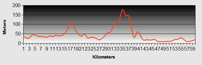
Our ride descriptions give an account of the ride that we completed. As part of the description we also provide links to Wikiloc or Google maps and elevation profiles based on mapping data available through the internet. The ride profiles are smoothed to give what in our opinion is a more beneficial view of the profile. We use paper maps, GPS and on line data to plan and conduct our rides. We are happy for you to use our descriptions, but be aware that we do not guarantee the accuracy of the information provided as situations surrounding any ride change over time.
West Coast - Day 1 - Motueka
|
 |
|
The rain was constant during the night, but not as heavy as we feared.
The morning news was full of reports of the worst floods in over 100
years. Roads to Nelson, Golden Bay and the West were all closed due to
flooding and land slips. Luckily our route up the Motueka valley was
unaffected. The river was enormously swollen, carrying huge tree trunks
and other forest debris downstream.
|
 |
It was a long slow up hill following the river valley, stopping along
the way at the Ngatimoti winery and cafe for light refreshment. Here we
met a Spanish guy, David who was also cycling in our direction.
As we continued up the hill it started to rain quite heavily. We
pedalled onwards waiting for the rain to stop. It was well gone 3pm
when, with no abating of the rain, we sheltered in the hedge bottom to
eat our lunch. The last bit of the hill was steep, squeezing through a
cutting at its peak through which the wind howled in our faces.
Once down the other side the valley flattened out again and we sailed
into the camp site at Tapewera. We tried to get a cabin as it was still
raining, but they were all booked. We just finished pitching the tent
to tell us that she had had a cancellation, but by this time the rain
had stopped and we decided to sleep in the tent anyway.
David the Spaniard arrived shortly after us and We spent a long time
talking with him about his experiences cycling in South America and
South East Asia.
The kitchen was well equipped and stocked with herbs and spices. It had to get the best marks so far.
West Coast - Day 2 - Tapawera
|
 |
Ride Description
|
On the way out of Tapawera we stopped at the museum housed in a tiny shed (actually the old "Kiwi" station office) on the site of the old railway station. Inside the displays told the story of how in 1955 a group of local women tried to stop the planned closure of the railway by sitting on the lines for a week. They kept themselves busy during this time by doing their darning and knitting. By the end of the week they were forcibly removed and arrested and the railway was dismantled. We thought it would make a good film story along similar lines to the Calender Girls, but without the nudity. |
 |
It was a gentle up hill, turning south on SH 6 at Kohatu for 10 very busy and pressurised kilometres before turning off on a minor road to Tophouse. This was a beautiful quite valley with few cars, mostly pine plantation. Eventually we reached the Wairau Saddle at 710m. As we sped down the hill to St. Arnaud, we were passed by a group of young men who applauded us loudly out of the car windows.
Arriving at the DOC office at Lake Roatiti we found that the camp site
was full. The helpful DOC lady suggested that we drove 20km down the
road to the next site. Steve made it clear that we were not cycling any
further and needed to pitch our tent close to the town. She then
confided, quietly that there was a freedom camp area just down the road,
but they didn't advertise it too widely. After three abortive attempts
to find the site we finally accosted a mountain biking couple (much
older than us). They led us along a path through the bushes signposted
"Teetotal Mountain Bike Trail".
The small grassy, sheltered area next to the "ice skating pond" was sand
fly heaven and they were biting us before we had even managed to prop
our bikes. As the camping was free we splashed out on a nice meal at the
Alpine Lodge Hotel.
West Coast - Day 3 - St. Arnaud
|
 |
Ride Description
The ride to Murchison was all downhill and we knew we could get there in
3 hours. So, we spent the morning walking a small section of the
footpath around the lake. As it was the middle of the main summer
holiday season, the lake was busy with boaters, kayakers, fishermen and
picnicking families.
We left St Arnaud at about 1pm following the Buller River valley. Even
though we were at 600m, the valley was wide and flat and we made good
time, averaging about 20-25km per hour.
The ride was as easy as we had expected and in no time at all we arrived in Murchison.
As the river was so high the kayaking fraternity were out in force.
There were drying wet suits, clothing and various kayaking debris lying
around the camp site.
West Coast - Day 4 - Murchison
|
 |
Ride Description
|
The ride profile showed another generally downhill day. However, the
road rolled and climbed along the side of the Upper Buller Gorge,
making for harder riding than we had expected.
|
 |
 |
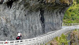
The road out of Murchison was busy, but after most of the traffic turned off up the Lewis Pass road we were treated to a quieter ride along the gorge.We paid our $5 to walk over the longest swing bridge in New Zealand, but we declined the $30 ride back on the flying fox (zip line). The bridge was built to give access to the gold mines on the far side of
the river. The area was also badly affected by the 1929 earthquake and
it was interesting to see the White Creek fault line which opened up as a
result of the quake. The land either side of the line was displaced by
some 4.5m.
|
|
Riding further along the gorge, it was dominated by large limestone cliffs that jutted out of the bush covering its slopes. |
 |
 |
At Inangahua we stopped for a ginger beer stimulus and called in at the
museum which showed many photos of the 1929 and 1968 earthquakes that
badly damaged the town, road and rail infrastructure.
|
|
Seeing our crestfallen faces they then invited us to share in the
barbecue that they were preparaing for some friends. After some good
food and a few beers they mentioned that they had "local's" tickets for
the PHAT 11 Music Event up in the forest at Inangahua and would we like
to go for a look.
|
 |
The last time that we had been to a rock concert was in our early
twenties. Most of the attendees were younger than our own kids. Some
were dressed in costumes, others were dressed in very little except a
few glow sticks. There were vendors selling food, new world gifts,
incense and stuff that we maybe shouldn't mention.
The music was mixed by such acts as the Salmonella Dub, Sickcycle,Aunt
Ethel, Pants Off, TooFar Gone, Titts Mcgee and Naughty Chicken. (we
didn't stay around for the live bands). It was loud and throbbing. The
whole experience was like being on the planet Zog.
West Coast - Day 5 - Berlins
|
 |
Ride Description
|
We decided to stay for only one night, as Berlins just didn't meet our expectations.
|
 |
 |
Originally, we planned to cycle only as far as Westport on the West Coast, but we made
good progress arriving there in time for lunch. We did some shopping and
continued on to Charleston, about 25km down the coast.
|
We tried to find a free camp area indicated in our guide but couldn't
find it and opted to check into the camp ground in the village. After
we complained about the closure of the pub, the camp ground manager told
us that if we walked 50m to the village hall we could buy a pint there.
Before dinner, we walked down to the two adjacent bays, Joyce and Constance and then walked back for the well earned pint.
West Coast - Day 6 - Charleston
|
 |
Ride Description
|
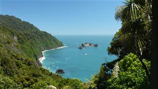
The ride to Punakaiki was a bit like riding the Big Sur, on a smaller scale, as we climbed several bluffs or points and descended into wild and windy bays. The most spectacular views were found at Perpendicular Point, lookingall the way back up the West Coast. |
 |
 |
Prior to the road being completed in 1929 the only way for the local Maoris and later gold diggers and settlers to access the coast was from the sea, climbing the cliffs by rope ladders. There were numerous ship wrecks along this west coast. |
|
The camp site at Punakaiki is next to the beach and behind the Punakaiki Tavern, which serves great beer and food and has a lovely warm wood burner warming the lounge. |
 |
 |
That evening we walked the track up the Paparoa Gorge through beautiful forest and towering limestone cliffs on either side. The river was deep and blue, flowing into pools dotted with massive boulders. The forest here was dotted with unique palm trees, only found in this north west coast area of New Zealand. |
|
Here also we came across our first bush robin, so friendly and unafraid. He perched on a tall mossy tree stump just next to us, waited while we got out the camera and adjusted the focus before striking several photogenic poses to ensure we had the perfect photo. |
 |
 |
We climbed up through beech forest to the ridge, dropping down into the
next valley which took us back down to the sea and a walk back along the
west coast road to Pancake Rocks.
|
West Coast - Day 7 - Punakaiki
|
 |
Ride Description
|
It had rained overnight and was still spitting when we awoke. By the time we had breakfasted it had stopped and the wind had switched to a northerly. We timed our departure to coincide with the high tide, hoping to find ideal conditions for the blow holes at Pancake Rocks, but the wind was low and the sea was flat, so no spectacular display. |
 |
With the wind behind us for the first time since we arrived in NZ, we
sailed along the undulating west coast road. The terrain switched between boring
long sections of flat featureless meadows behind a distant line of sand
dunes, to the high,rocky cliffs and forested bluffs that separated the
bays.
After a couple of hours we arrived in Greymouth. The train from
Christchurch, through Arthur's Pass terminates here and as we did our
shopping at the supermarket, travellers awaited the arrival of the next
train. The town is known to ge 'Grey by name, grey by nature' but we
managed to see it in a rare bright interlude.
We had planned to stay in Greymouth but as the weather was favourable we
stocked up with food and continued South. The west coast road here was flat and
featureless, away from the sea. It reminded us of some of the cless
attractive parts of the Lincolnshire Coast in the UK. The following
wind pushed us on and we completed the next 40km in less than 2 hours.
Shortly before Hokitika the rain started, slowly at first, but by the
time we arrived in the town it was pouring. We changed our mind about
camping and having rung round all the hostels in the town, we found a
room at the Mountain Jade Backpackers in the town centre.
Having checked in, we didn't go out again, as the rain was torrential
and lasted all night. Everyone there was fed up with the bad weather
that they had come through from the South and which looked set to stay
for the next four days.
West Coast - Day 8 - Hokitika
|
 |
Ride Description
|
At last the rain to stopped around 10-00. The wind still favoured us,
but the ride was harder with continuous ups and downs through beautiful
forest.
|
 |
At Lake Ianthe we stopped for lunch. The water had risen to excessive levels. Steve had trouble starting the barbecue and Karen had to wade to the picnic table with our food.
The ride was now shadowing the huge mountain ranges to our left as we
crossed over rivers and creeks swelled by the heavy rains. As the
terrain was largely flat we were pushing ourselves hard and when we
arrived at Harihari we were exhausted. First stop was for a long glass
of water and a beer at the village store. By now it was raining again
and we decided to check into the motel rather than camp. It was basic
and didn't have any kitchen facilities, but it was warm and dry with
crisp clean sheets on the beds.
Stephen and Guy, the two cyclists that we had met earlier were camping
there also and that evening we spent the evening in the bar chatting
with them about their adventures and enjoying jugs of the hotel's
Christmas ale.
West Coast - Day 9 - Hari Hari
|
 |
Ride Description
Again the rain had persisted all night and was still pouring when we
awoke, promptly rolling over again and snuggling back into our beds.
There seemed little point in staying put so after our breakfast of
porridge (the first for months), we mounted our trusty steeds and headed
off along the west coast road in the rainy but very warm humid conditions.
Mount Hercules appeared after about 10km and as we started to climb
Steve stopped to strip off his T shirt, continuing in true macho style
with just his high viz waistcoat on. Stephen and Guy passed us on the
hill. Riding through more lovely forest, enhanced by our happy glasses
(yellow lenses), we crested the hill and raced down the other side and
still the rain poured down.
As we got closer to the Alps we caught tantalising glimpses of the
3,000m snow topped peaks as the clouds swirled over the hills and
valleys.
The halfway point was at Whataroa and we had the most excellent
cheeseburgers, chips and mugs of teas to revive us for the last 30 km.
Before we left Harihari we had called one of the hostels in Franz Josef
and they had told us they were full, so we thought we had better call
the rest to see if we could get a room. They were all fully booked apart
from the Rainforest Retreat and even they could only offer us a shared
room or a camp site.
We briefly caught sight of Stephen and Guy as we came into town. They
were just leaving and it would be the last time we would see them for a
while. After all, they did have about 15 years on us and were carrying
perhaps half the weight.
It was now a pretty, gradual climb to Franz Josef, passing Lakes Wahapo
and Mapourika along the way. As we rode into Franz Josef all of the
hotels, B & Bs, motels and hostels were all showing "No Vacancy".
When we arrived at the Rainforest Retreat we opted for the shared room.
At least we would be warm and dry.
Franz Josef has the feel of a manufactured alpine ski town. It
comprises a full range of mainly tourist accommodation and the services
and companies to service the tourist trade. Through the clouds we
could occasionally see the lower end of the Franz Josef glacier high up
the mountain.
The following morning it was raining hard and we decided to stay another
night. Steve went to reception to book us in. We had to change to a
sole use room with ensuite which cost more at $85. While he was stood
there, the cleaning supervisor came in and complained to the boss that
he didn't have enough WOOFER's (i.e. folks willing to work in exchange
for their board and lodging). Steve wasted no time in volunteering our
services and that is how we ended up cleaning rooms for half the day in
Franz Josef. We had to work fast as the Kiwi Express bus was expected
and the tourists would want their rooms, but by 14-00 our work was done.
It was still pouring and we trudged into town for lunch. The rain
continued all day and into the night. We wondered if we were going to
be marooned for another day.
West Coast - Day 10 - Franz Josef
|
 |
Ride Description
|
At last, this morning the rain had stopped and the clouds were clearing. We could occasionally see patches of blue sky and tops of the mountains. So with our spirits lifted we set off to see the Franz Josef Glacier. Just a few kilometres south of the town the road turned left up the valley. The river was swollen and grey with sediment. Large pieces of ice washed down the river and some collected on the banks. Although we were riding through rain forest that would normally be warm and humid, the effects of the icy river was to cool the whole bottom of the valley. |
 |
 |
It was a short 4km ride to the car park at the end of the track, where we left our bikes and walked the short path through the bush to reach the glacier viewing point. As we returned we were nearly trampled underfoot by hoards of tourists being led onto the glacier by a guide, who carried a large pick-axe. The trekkers were all dressed as if they were going on an Arctic expedition. The contrast between the bush covered valley sides and the rock strewn gorge carved out by the icy blue glacier was startling. |
|
The west coast road between Franz Josef and Fox Glacier crosses over three high saddles. The rain caught us again at the bottom of the Cook Saddle, the steepest of the three climbs. We arrived in Fox Glacier slightly wetter than when we had started and ordered a pizza at a street side cafe. As we were eating Stephen and Guy came passed and we followed shortly behind them for the ride up to the glacier. Unfortunately we couldn't follow the footpath to the base of the ice as it had been washed out by heavy rains. We didn't leave the glacier until 3-30pm and still had 35km to ride, with a strong head wind.
|
 |
West Coast -Day 11 - Jacob's River
|
 |
Ride Description
|
Today started sunny and cloudless. As we rode and looked back we had beautiful views of Mount Cook in the distance. After only an hour's riding along the west coast road we stopped at a salmon farm and cafe and bought a fillet for tonight's dinner.
|
 |
 |
The west coast road was through lovely forested, flat terrain taking us passed Lake
Paringa and Lake Moeraki. Between the two lakes we came around a bend
we saw some bee hives at the road side. Suddenly there seemed to be
hundreds of buzzing, angry bees darting back and forth and colliding
with us as we rode. It was difficult to decide whether to ride fast or
slow in order to avoid them. After about a kilometre we saw the reason
for their fury. A group of apiarists were collecting honey from the
hives. We could smell the smoke from their burners. Above the hives was
another huge swarm of angry bees.
|
|
Further along the west coast road we reached Ship Creek and as it was so hot we stopped for a swim at the mouth of the river. Even when we were swimming the sand flies still chased us and gathered around our heads. It was unbearable and we quickly had to get out and get changed, all the time being attacked by the voracious beasties. |
 |
The approach to Haast township was over a single lane bridge spanning
some 750 metres across the alluvial plain of the Haast river, with the
brooding Mataketake mountain range as its backdrop.
That night we camped and once again enjoyed a pint or three with Stephen and Guy.
New! Comments
Have your say about what you just read! Leave me a comment in the box below.